Bremen Airport (BRE)
City Orientation and Maps
(Bremen, Germany)
Located on the banks of the Weser River, the city of Bremen is famous for its local beer and is also known for its liberal politics. Bremen is a city of energy and history, full of old buildings, large parklands and many popular eateries.
Bremen has a population approaching 600,000 and is also home to its own airport, standing on the city's southern outskirts. Founded at the end of the 8th century, the city is close to the port of Bremerhaven, which is located around 65 km / 40 miles to the north. Also nearby, Hamburg can be reached in around one and a half hours, lying to the north-east, while Hannover is a similar distance to the south-east.
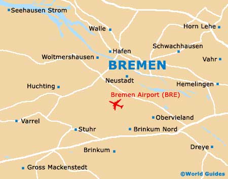
Bremen Airport (BRE) Maps: Important City Districts
The city centre is easily walkable and fairly compact, with most places of interest close to each other. On the northern side of Bremen, the Altstadt district is situated alongside the Wallanlagen park, next to the historic city walls.
Bremen's train station, known as the 'Hauptbahnhof', is situated slightly to the north and contains the local tourist office, next to the bus station. The Markt area of Bremen can be reached by walking along the Bahnhofstrasse, which in turn leads to the Sogestrasse. Other areas of interest include the entertainment quarter on the eastern side of the Aldstadt, and the Rathaus neighbourhood, close to the Markt.
Germany Map

Bremen Map